The walk begins at Cottage Green, where the Reverend Robert Knopwood was granted 30 acres of land which encompassed most of the area between today’s Salamanca Place and Hampden Road in 1805. Here he built his home, Cottage Green, the first in Battery Point, on the rise above the present day Wursthaus Kitchen, and he immediately established a productive garden.
He grew both ornamental and useful plants and often noted visitors in his diary. In 1805, these included an Aboriginal woman and her child who camped at the bottom of his garden on the shoreline before disappearing. Thus began a much longer tale of Aboriginal expropriation across the island.
Other colonists delighted in his garden.
Mrs Collins returned and took fruit at my house; Mrs Birch and Mrs Mitchell came and walked in my garden.
– 5 Feb 1815
Although Knopwood had difficulties with the government, many people appreciated him. Henry Savery, a Bristol merchant transported for forgery who later became Australia’s first novelist, wrote that:
[Knopwood] possessed a remarkably mild, placid countenance and his manners were easy and gentlemanly in the extreme; his conversation was lively and agreeable, and we soon appeared perfectly to understand each other.
– The Hermit in Van Diemens Land, Henry Savery
Although he never married, Knopwood adopted a young orphan girl, his beloved Betsy Mack.
As shipping activities increased with the development of New Wharf (now Princes Wharf), so too did the value of Knopwood’s land. However, financial problems forced him to sell several allotments in 1824 to merchants along what is now Montpelier Retreat. Later, the remainder of his land was taken over by Lieut. Governor Arthur in 1829 in a questionable land deal. Knopwood packed up and left his beloved Cottage Green a sad and bitter man.
… his manners were easy and gentlemanly in the extreme; his conversation was lively and agreeable, and we soon appeared perfectly to understand each other…
Listen
When my man came this morning I enquired what had become of my sable guests that came the eve before and was informed that they were in the kitchen and had breakfasted of bread, potatoes, meat etc. When I got up they were then going away with the whole party … I walked down the garden and found that the natives had made a fire at the bottom of my land and were getting oysters and mussels. At different times of the day, many of the inhabitants came to see the natives. They stayed there all the day and night.
– November 1815, extract from Reverend Robert Knopwood’s Diary
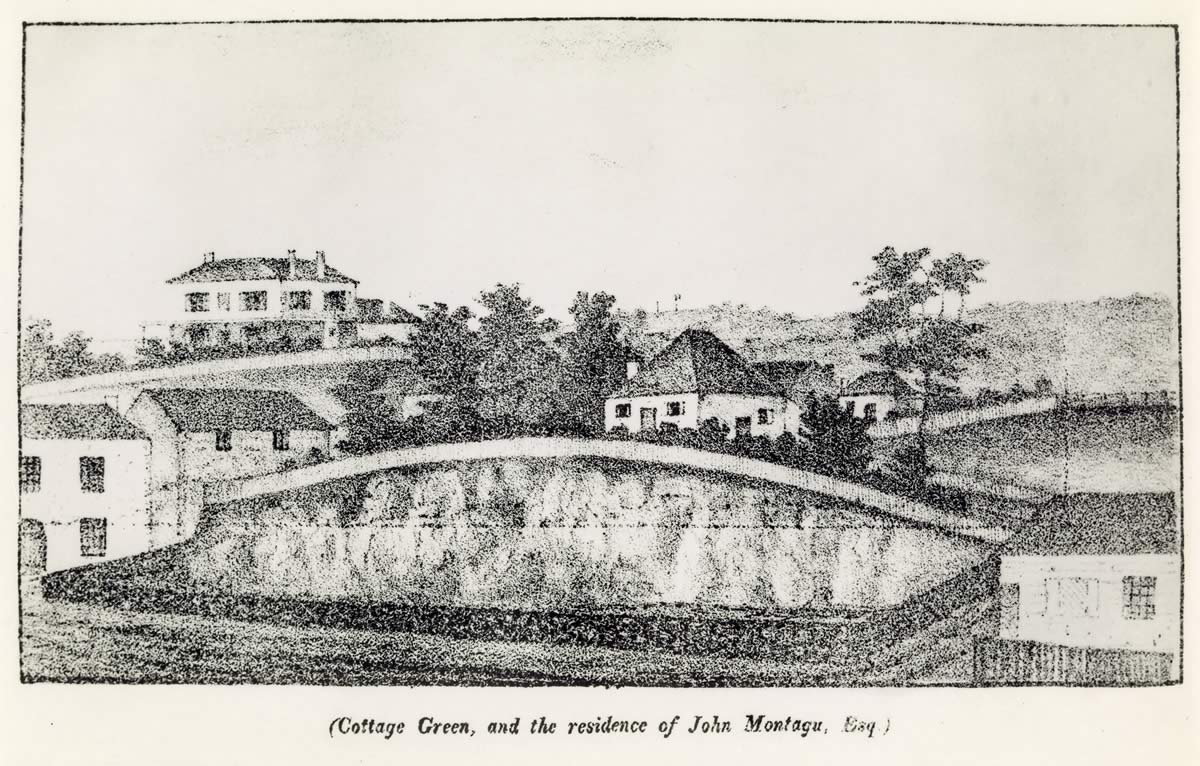
Sketch of Cottage Green, Hobart Town Magazine, January 1834
The cottage sits on top of the ridge between Montpelier Retreat and Gladstone Street with Stowell behind. The arched doorway to the far left is 2–4 Montpelier Retreat, still visible today.
Source
Tasmanian Archive and Heritage Office PH30 1 4733
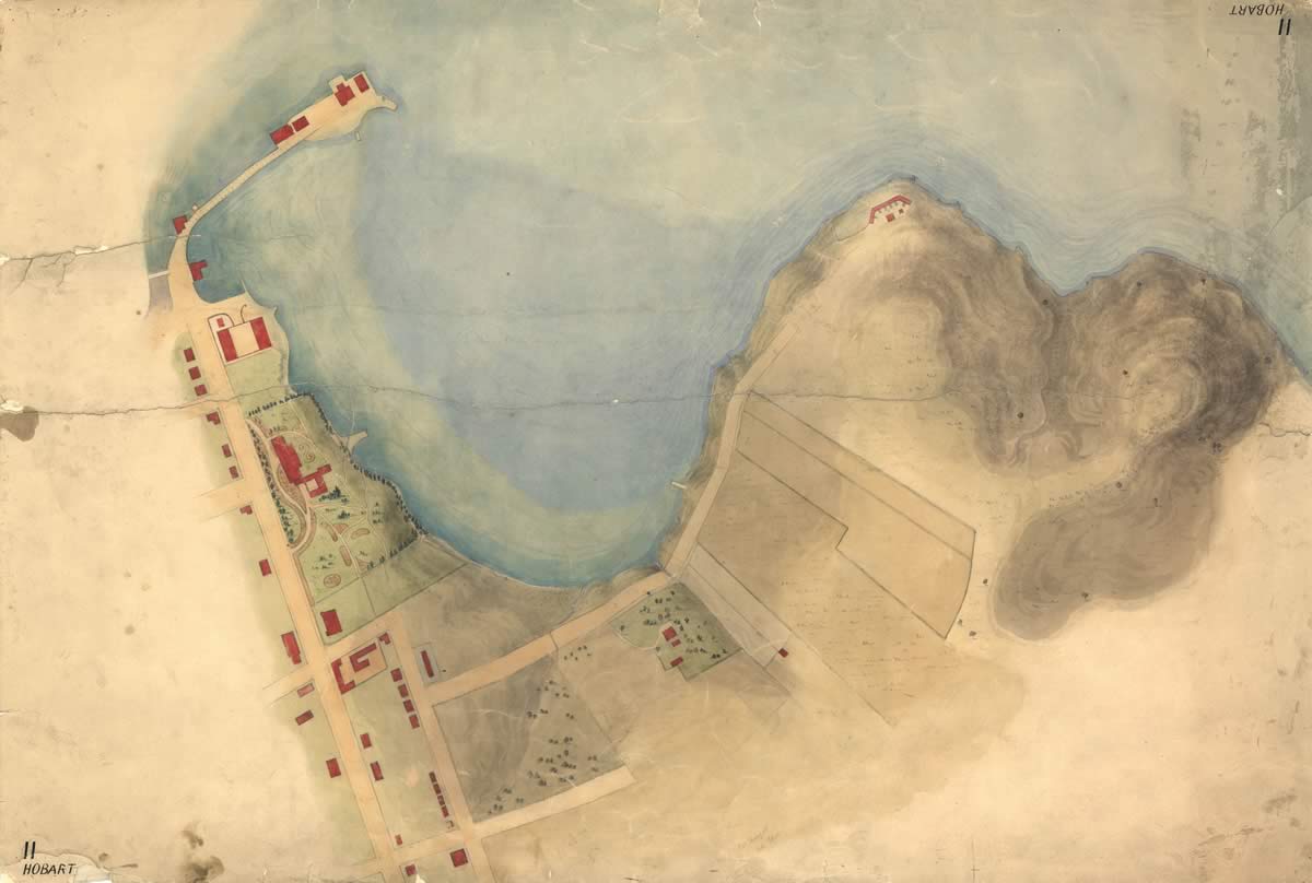
Map – Hobart 11 – Sullivans Cove and part of Hobart Town 1827
Showing Cottage Green on the southern shore of Sullivans Cove.
Source
Tasmanian Archive and Heritage Office AF394 1 170
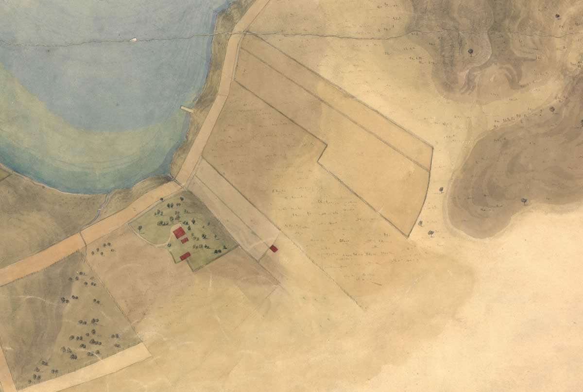
Detail from Hobart No. 11 Sullivans Cove and part of Hobart Town shows Cottage Green on the waterfront 1827
At that time, Knopwood’s was the only house in this area. The bank sloped down to the water, where the New Wharf was later built. The house was only a little back from the beach.
Source
Tasmanian Archive and Heritage Office AF394 1 170
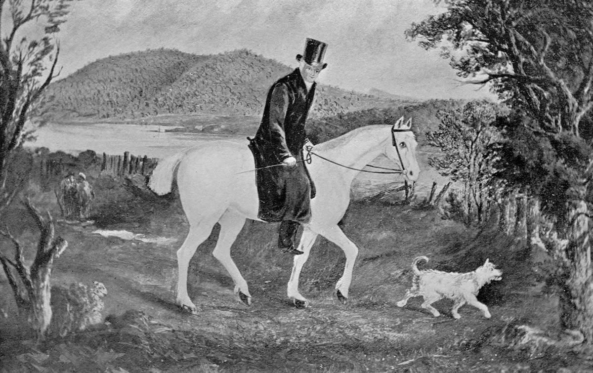
Bobby Knopwood, his pony and Pincher
The bottles next seen peeping out – you may readily divine
His error is one of mercy – and he carries with him wine.
This fine old English clergyman – one of the good old sort
Who, when he visited the sick – he always brought them port!
– from poem by Knopwood’s friend T. G. Gregson
Source
Tasmanian Archive and Heritage Office AB713 1 2879
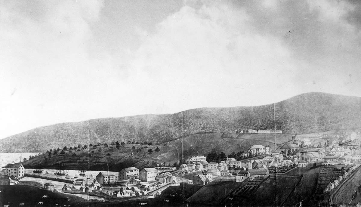
Battery Point 1827
Battery Point lies in the middle ground; it is mostly open land as it is still Knopwood’s farm.
Source
Tasmanian Museum and Art Gallery Q194.42
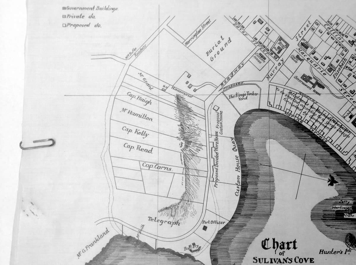
Chart of Sullivan’s Cove 1832
The plan is based on a proposal plan showing existing and proposed development of Sullivan’s Cove prepared by John Lee Archer in 1828 and submitted to the Executive Council. This early map shows the land grants after the split up of Knopwood’s land. This is just before the decline in the bay whaling industry.
Source
Hobart Town, Van Diemen’s Land Chart of Sullivan’s Cove published in Charles Medyett Godridge, Narrative of a Voyage to the South Seas 1832
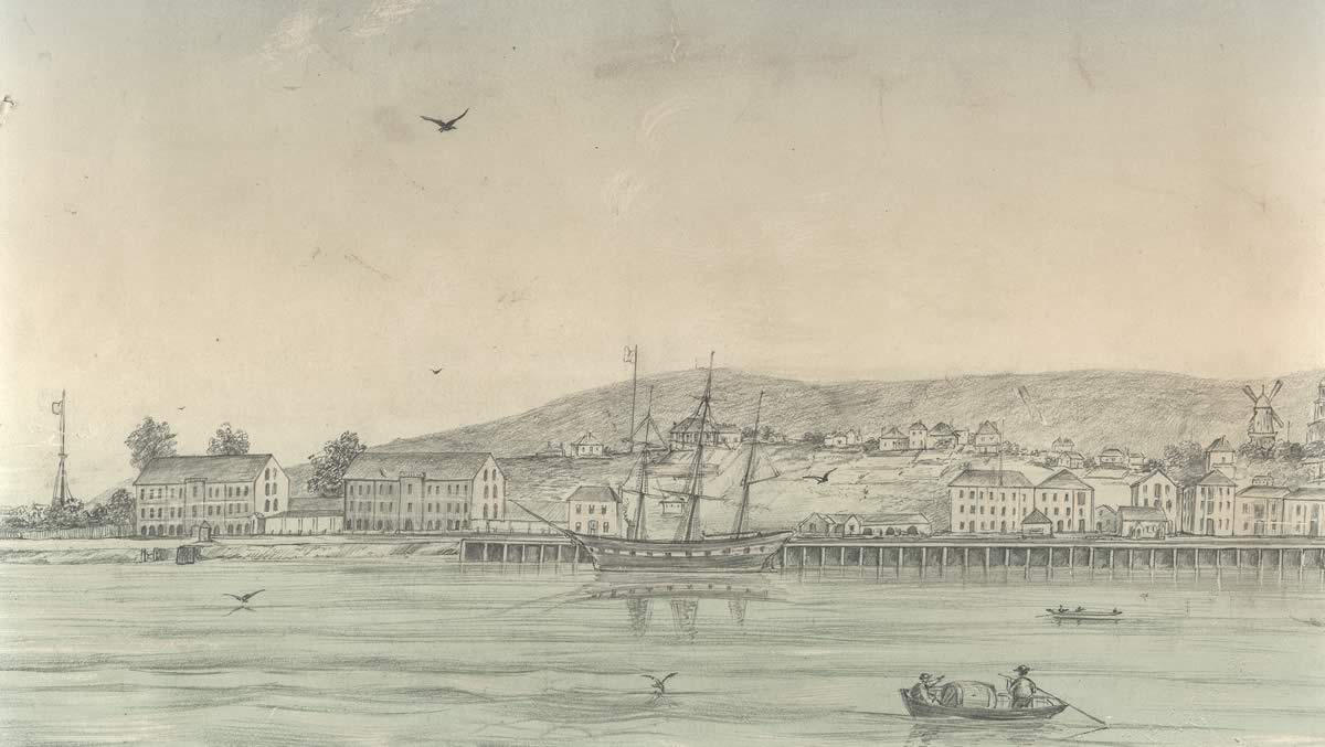
The New Wharf and Battery Point c1856
Source
W L Crowther Library, Tasmanian Archive and Heritage Office AUTAS001125294298
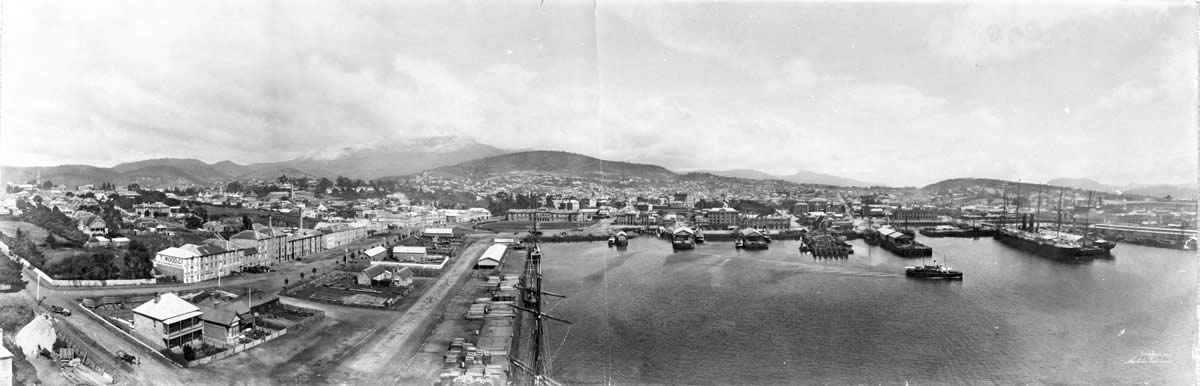
Panorama of Hobart 1904
The waterfront was largely an industrial area and included various businesses like jam factories, venetian blind and broom manufacturers, Kennedy’s iron foundry and road metal quarry, and the Vacuum Oil Company. New Wharf was transitioning from mercantile to industrial uses but still employed the local Battery Point workers. As these industries in turn declined from the 1960s, the waterfront was again transformed into today’s pedestrian friendly, restaurant and arts precinct.
Source
Photographer Melvin Vaniman, Tasmanian Museum and Art Gallery Q344
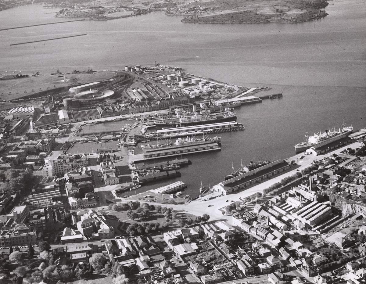
Montpelier Retreat leading from Salamanca Place 1946
Source
Tasmanian Archive and Heritage Office – edited detail of part of Sullivans Cove aerial photograph PH30 1 3096
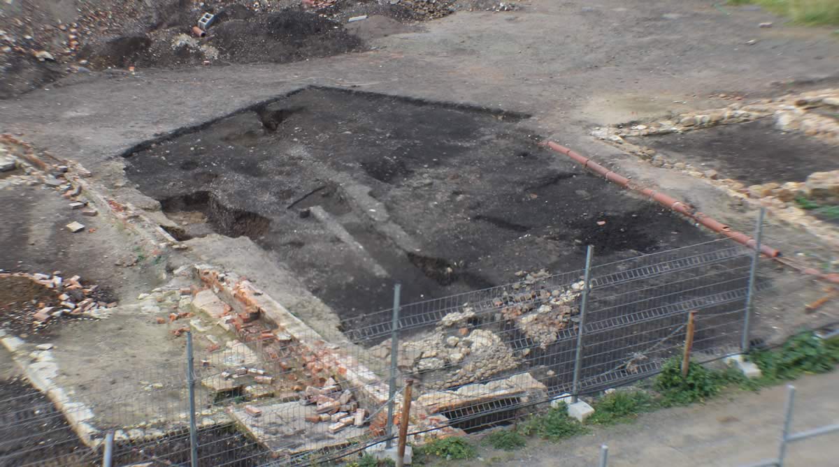
Archaeological excavation in Montpelier Retreat 2015
Knopwood’s Cottage Green is believed to be in the vicinity of this site. It was probably overlaid by Orr’s outbuildings.
Photo
Robert Vincent